Pacific Northwest Adventure: Mount Hood
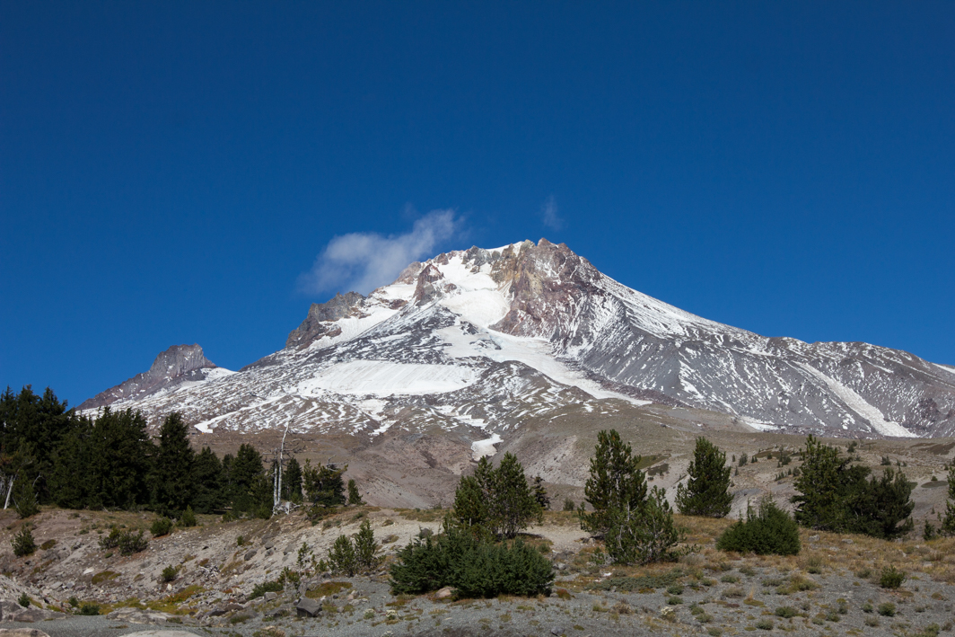
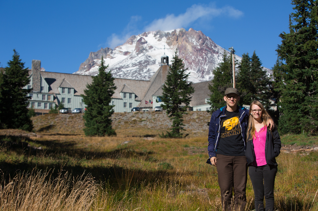
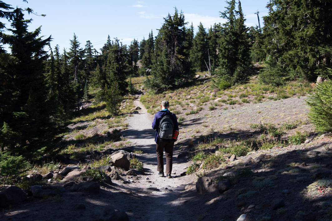

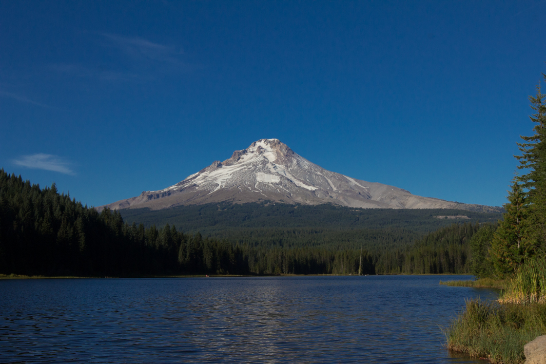
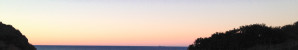
 As promised, a few images and notes from our trip to the Pacific Northwest. We started our trip in Portland with breakfast at Vita Cafe. After walking around for a bit we grabbed some treats to go from Back to Eden and headed up to Mount Hood. The Timberline Lodge that is perched half way up the volcano is where some of the exterior shots in The Shining were filmed. It was too early in the year for snow at that level but it was lovely to walk along a tiny bit of the Pacific Crest Trail that I’ve been reading so much about for the past year.
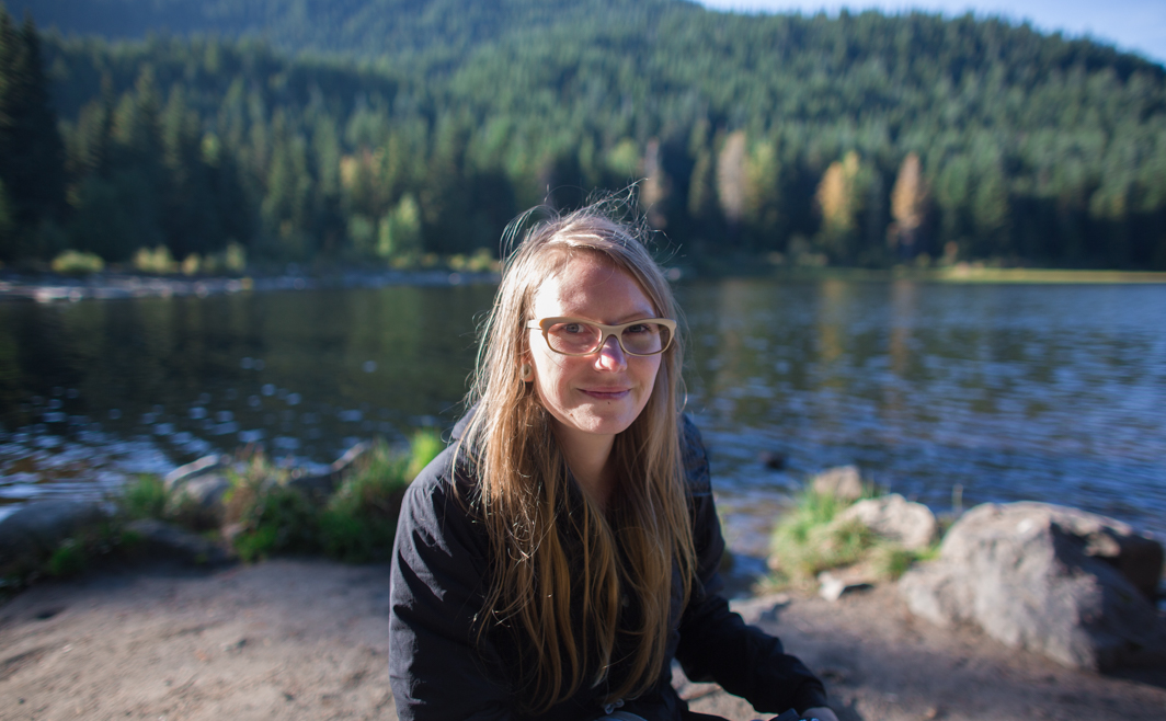
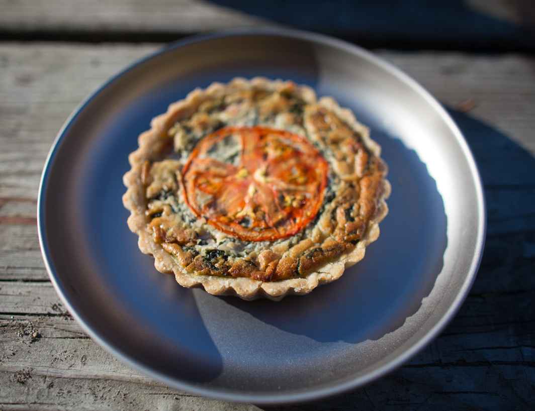
After doing a little bit of hiking and exploring the lodge itself, we made our way down the mountain to Mirror Lake where we ate the quiches and pastries that we had picked up from Back to Eden. They were delicious, all having a singular flavor, and the perfect picnic meal. We walked around the lake before it got dark, enjoying the views of the mountain and the wooded terrain.
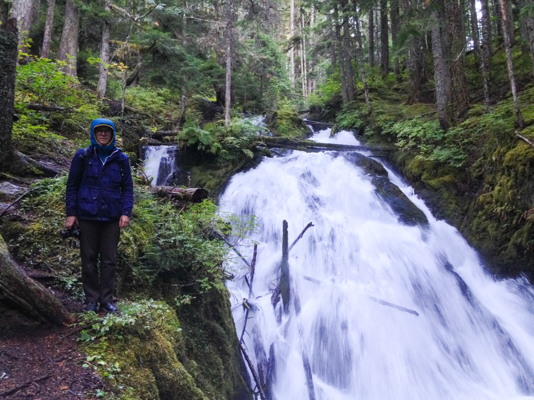
Making our way back towards Portland, we stopped and hiked up to Little Zigzag Falls. The short trail was lush and green and beautiful. It was such a stark contrast to all the dried up rivers and streams that I’m used to in California. Seeing water rush over the falls was a real treat.
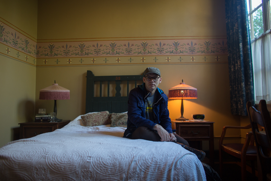
We spent the night at McMenamin’s Kennedy School. Last time we were in Portland, we had stayed at the Ace, which was great for exploring the whole city on bikes. We both loved the vibe of the Kennedy School, with its long hallways and hidden rooms. It was conveniently close to so many of the restaurants we wanted to visit and just blocks from our favorite bar, The Bye and Bye.
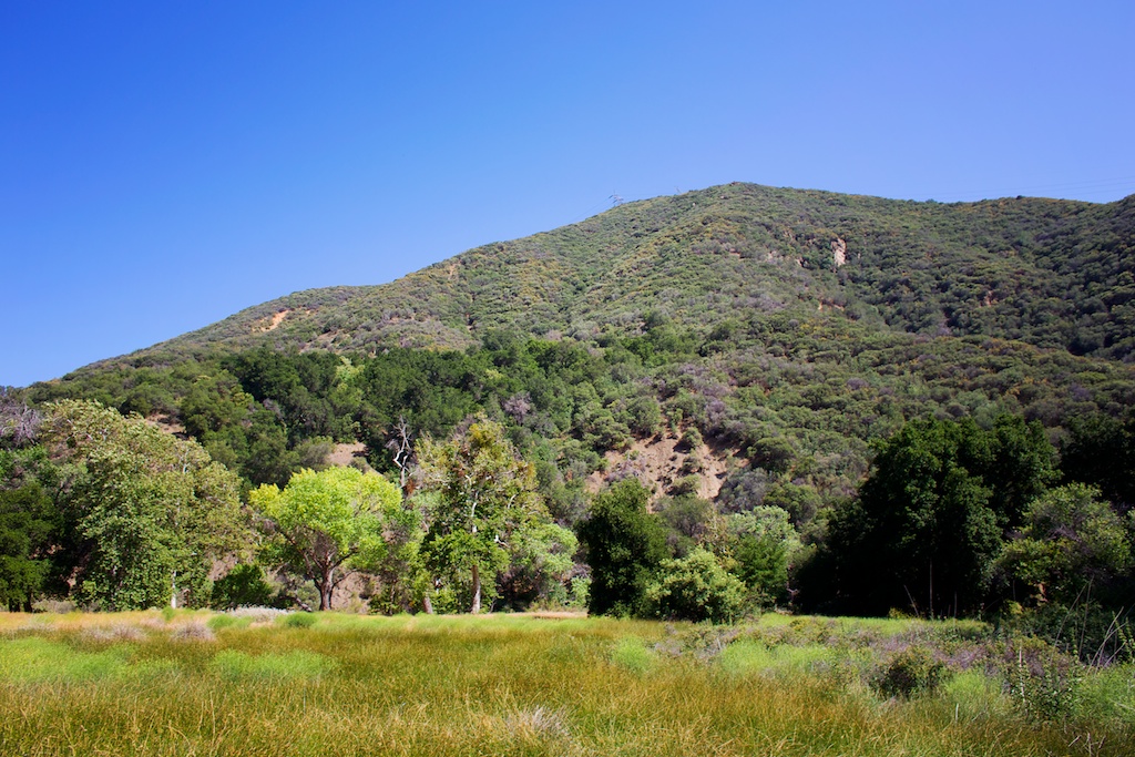
Previously, riding bikes around Portland really allowed us to connect with the city, to travel slowly and take in all the different places we visited. This time, while we did a fair amount of walking around, we opted to try and visit as much of the Pacific Northwest as possible, getting more of a sense of the whole area, rather than just Portland specifically. While it wasn’t quite as immersive, it was great to see some of they outlying areas like Mt. Hood.
Next up: we travel up to Washington to see the Olympic National Park.
mt baldy loop hike
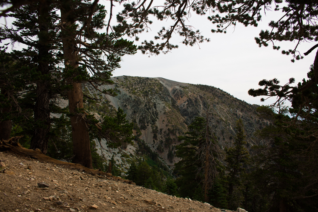
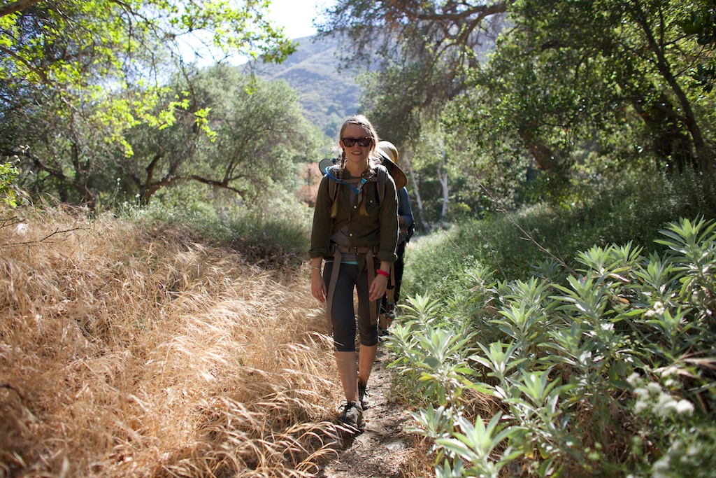
 As you might be able to tell, I’ve been in love with hiking and backpacking all summer. In reality though, I’m not super athletic. I spend most days at sitting at a desk, letting my muscles atrophy. On our last few backpacking trips I’ve found myself rather exhausted when we arrive at camp. Hiking with a backpack is so much more difficult than just regular hiking. I’ve known for awhile that I need to start pushing myself if I want to go on longer expeditions.
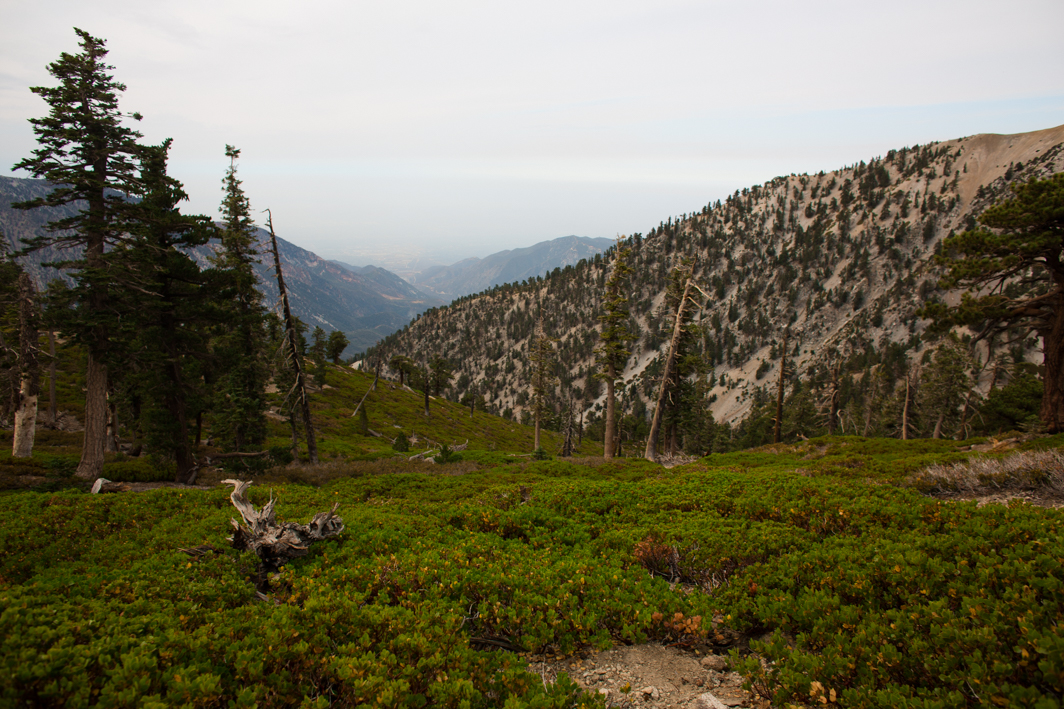
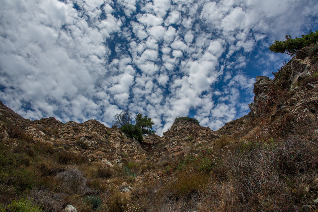
A few weeks ago I got it stuck in my head that we should hike up Mt. Baldy, the highest peak in the San Gabriel Mountains. It would be a long hike (the loop trail is just over 11 miles) and also one that would challenge my fears about elevations as the peak rises above 10,000 feet. Shawn was shocked that I wanted to do the hike, particularly because he has been asking me for years to go up to the ski hut in the winter. I always firmly decline. It always sounded terribly strenuous, even though he often assured me the hut wasn’t even at the top.
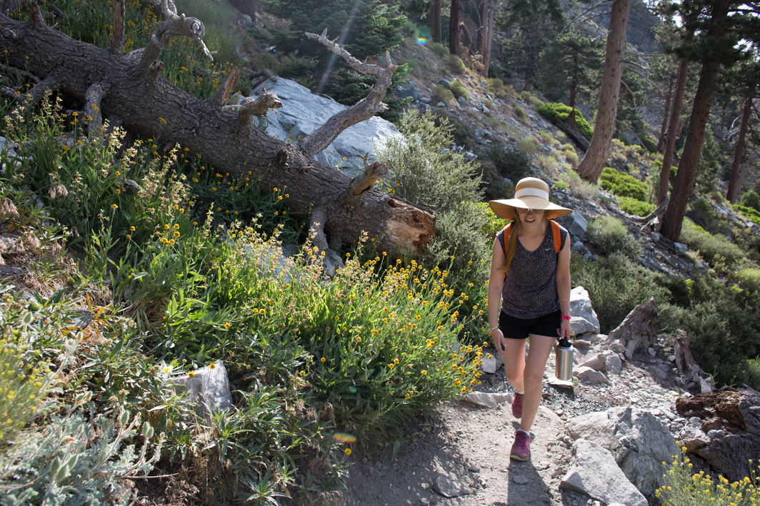
We started bright and early, trying to avoid hiking in the afternoon heat. Even at 7am there were numerous other hikers there, heading out onto the trail. I was nervous when we started but I psyched myself up for the day of hiking. As we started heading upward I saw the ski hut above us. I wasn’t totally sure If I could make it to the top but I made it a goal to at least make it that far. It wasn’t long before we had made it to the hut. There were lots of other hikers at this point. We stopped and had some snacks, then headed up the mountain. I still felt great and this propelled me forward up the mountain.
In the beginning of the hike, I had let others pass us since I am fairly slow. After leaving the hut, I felt energized and raced over the rocky path past groups. Though we were surrounded by people as we left the hut, everyone seemed to disperse as we made our way up. I kept repeating to myself onward and upward as a sort of incantation. We reached a section where people seemed to have cut trails in every direction. At one fork, we veered to the left and found ourselves curving around the side of the mountain. There was suddenly no one around.
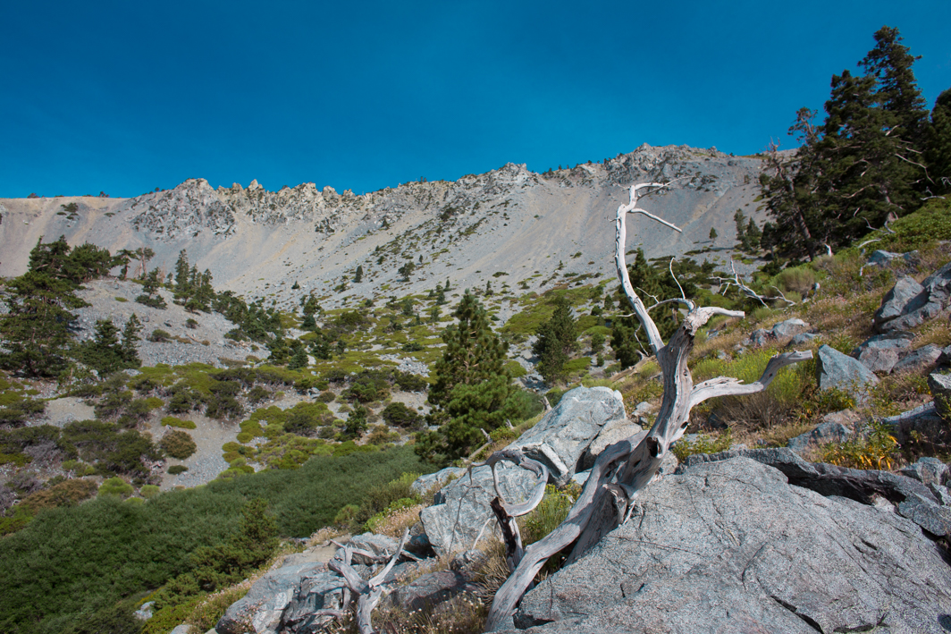
We walked on but didn’t seem to be going any higher. So of course, I was convinced we had gone the wrong way, knowing there are other trails in the area. My legs were starting to get seriously tired and the elevation was beginning to have an effect on me. I ate a fruit snack but it was so intensely sweet I couldn’t eat more. It’s strange how elevation can make things taste different. After walking for awhile more, we came upon the remains of an airplane crash. Finally we caught a glimpse of some hikers on a ridge above us and we cut up to meet them on the main trail.
Then it was just up and up and up. The trail was steep and I slowed down to a turtle’s pace. Yet I pushed forward. At once point, we passed a few hikers coming down and a woman, I’m sure seeing how I was struggling, told me that we were only five minutes from the top. I couldn’t even imagine the top at this point. My muscles felt like jello and my head like mush. I figured it was probably another 15 minutes and sure enough, five minutes later, another hiker heading down told us ten minutes more. The last five minutes felt like forever.
At the point where I could finally see the top, I sincerely felt like I could not make it that far. I also knew I had no choice so I just kept shuffling forward. Onward and upward. I wanted to cry (I didn’t cry).
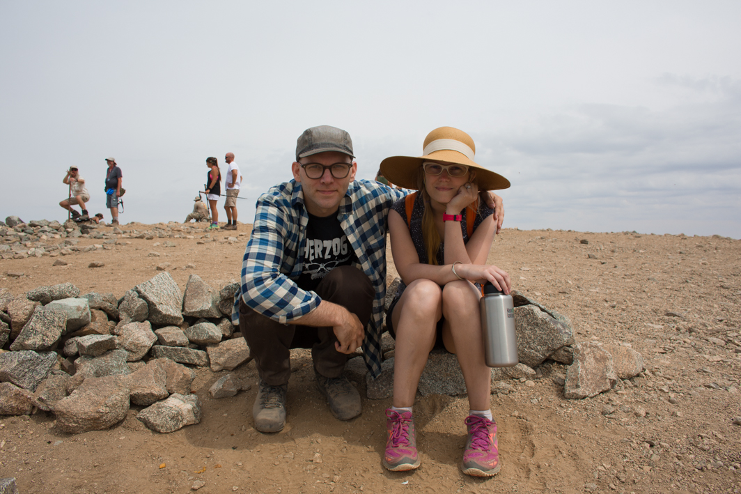
When we finally arrived at the peak I drifted around until I found a spot to sit. Everyone was relaxing, eating lunches, taking photos. I felt miserable. The elevation was hitting me hard. I wish I could say I felt triumphant at this point but I mostly felt like melting into the ground.
Not long after arriving we started our descent. I started to feel better as soon as we made it to a lower elevation. Unfortunately, the rocky trail down from the top was murder on my knee, particularly when my legs were already so exhausted. After awhile we stopped off to the side of the trail and ate burritos that we had brought with us. We were lucky in that the sky remained overcast so it was fairly cool for most of the day.
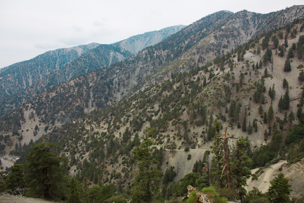
The descent over the devil’s backbone trail was a beautiful one. In one section we walked along the ridge with views down to either side of us. Though my knee hurt significantly on the way down, my enthusiasm rose as we walked downhill. At one point, we saw the ski lodge off in the distance and it seemed so far away. Eventually the trail led us straight to it. We wandered around for awhile and I thought about previous visits to the lodge. I’d only ever been when everything was covered in snow and it was curious to be there in the dry summer. The restaurant was still full and many people were riding the ski lifts.
From there, we still had about another three miles to go. Three miles is nothing on a normal day, particularly walking on the wide flat fire road. Space seemed to expand, drifting on and on, and still I was ecstatic to be nearing the end. We sang songs that I could not remember the words to (singing in front of anyone, even just Shawn, is not something I do often, which just shows how elated I must have been) and walked and walked and walked. Luckily the smooth road was much easier on my poor aching knee.
As we closed in the on the end of the trail, we came upon a few hikers coming down from the other side playing Kraftwerk from a tiny speaker. We picked up our pace to catch them and then in no time we were at the bottom, the whole hike completed. I ran the last hundred feet to make it back to the start in under 8 hours (so slow!).
Afterwards I was quite tired and my knee hurt like hell, but I was also super excited to have completed something I wasn’t sure I could finish. Despite being difficult and painful, I would do it again in a heartbeat. I know that besides the physical struggles, the hardest part for me is often in my own head. Knowing that I could accomplish something like this hike helps me combat some of the the things I often worry about. I did not feel well at the top, but I’ve certainly felt worse. I was able to climb nearly 4000′ in just 4.5 miles. I’m pretty happy with that alone.
I thought that after we finished the hike, we might relax for the rest of the weekend, lounge around and watch movies. Instead, we went on another, albeit much shorter and easier, hike the next day and it was great. If I could be hiking every day, I think that would be just fine with me.
photos by Shawn Bannon
Big Sur: Vicente Flats
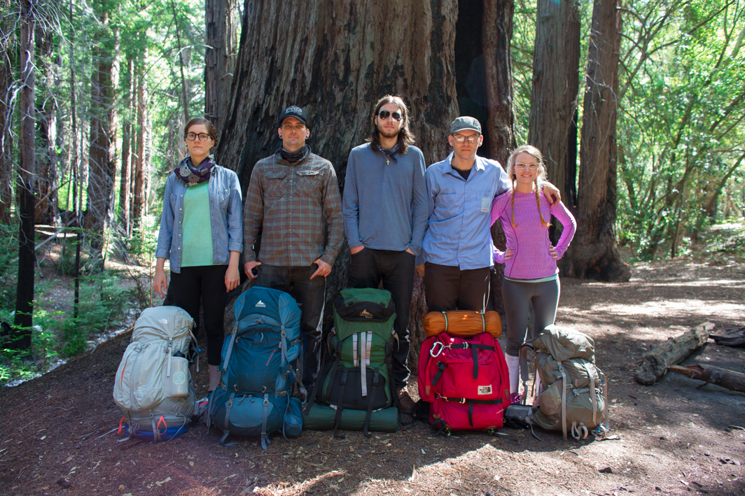


 Being the cool older brother that he is, Shawn wanted to plan something fun for Kyle’s birthday. Unlike many of the Batman themed events we’ve done in the past, we settled on a little backpacking trip in Big Sur, specifically a spot called Vicente Flats. We drove up early on Saturday morning and made it to Big Sur around noon.
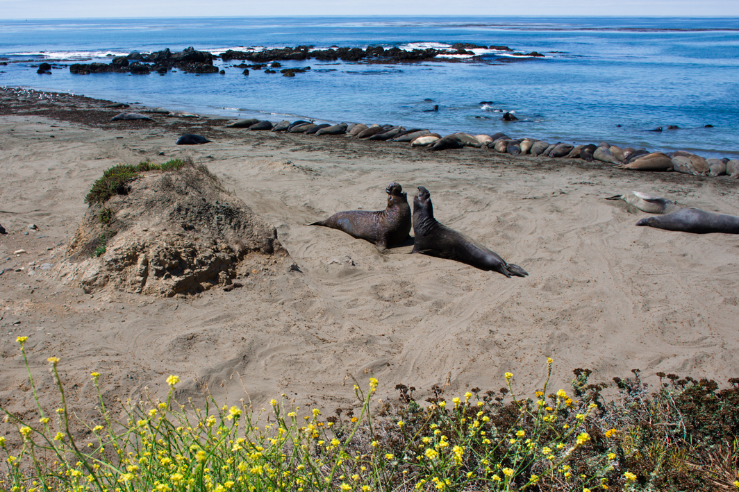
On the way, we stopped to check out the Elephant Seals on the beach. I honestly had no idea how awesome these animals were until we arrived on the beach to see them laying about and fighting in the water. All their blubber would ripple as they glided across the sand. And the noises! The beach was filled with mostly males and they sounded like crazy garbage disposals. In short, they were amazing. Summer is when there are the least seals on the beach, so now I’m really looking forward to coming back during pup season.
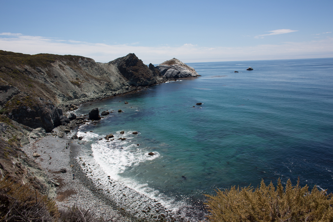
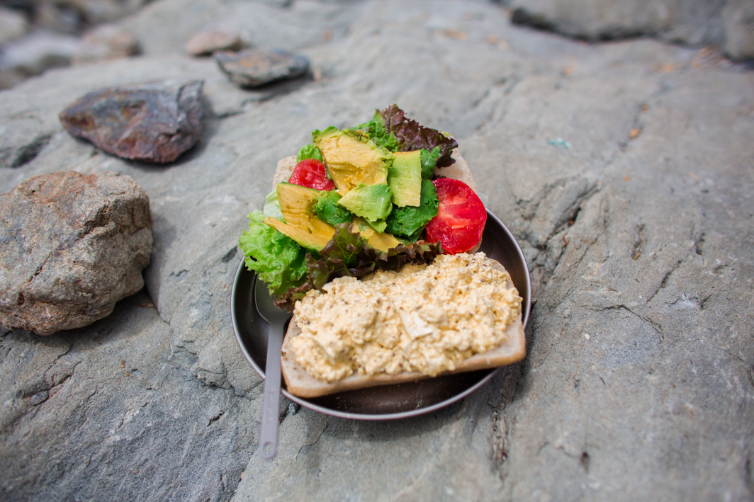
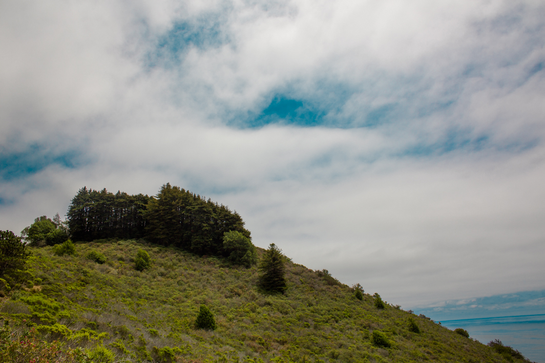
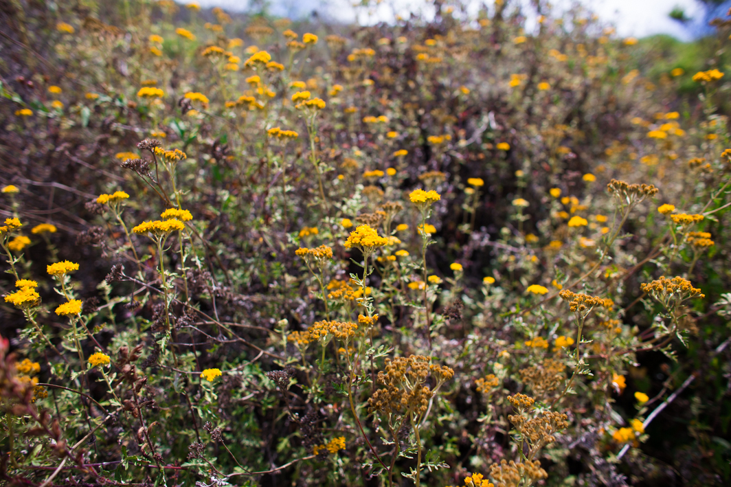
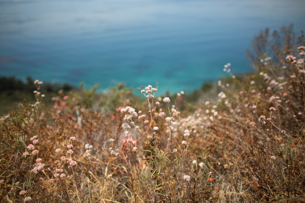
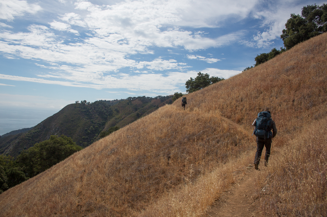
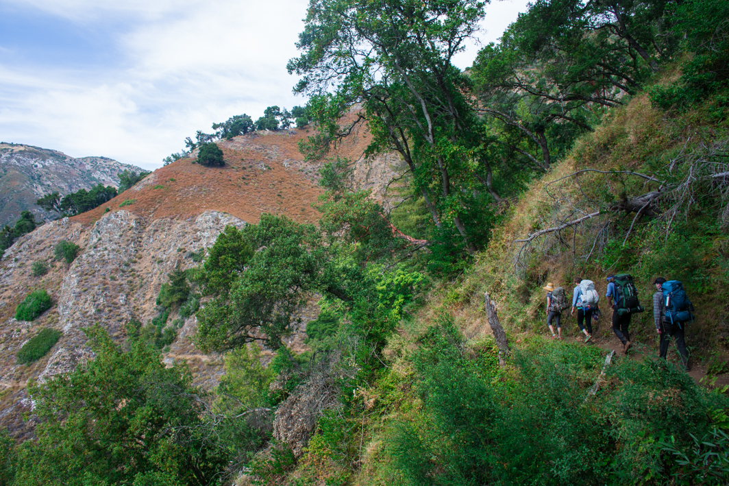
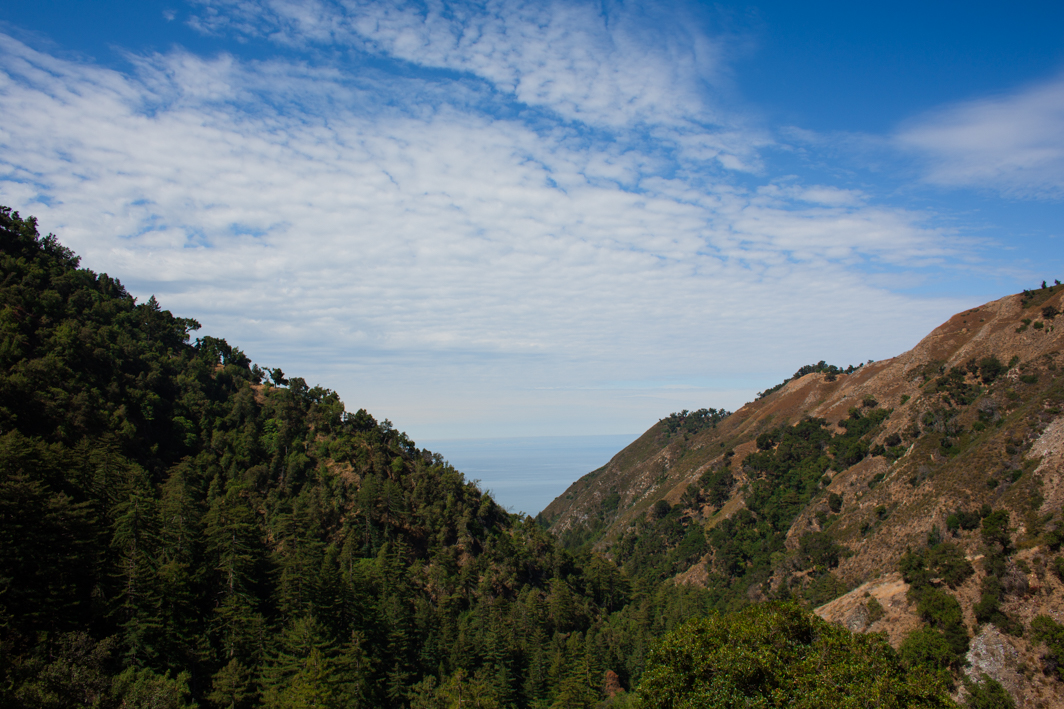
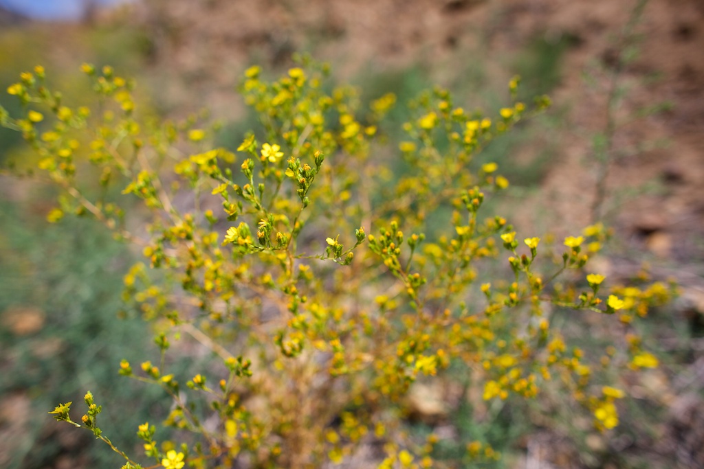
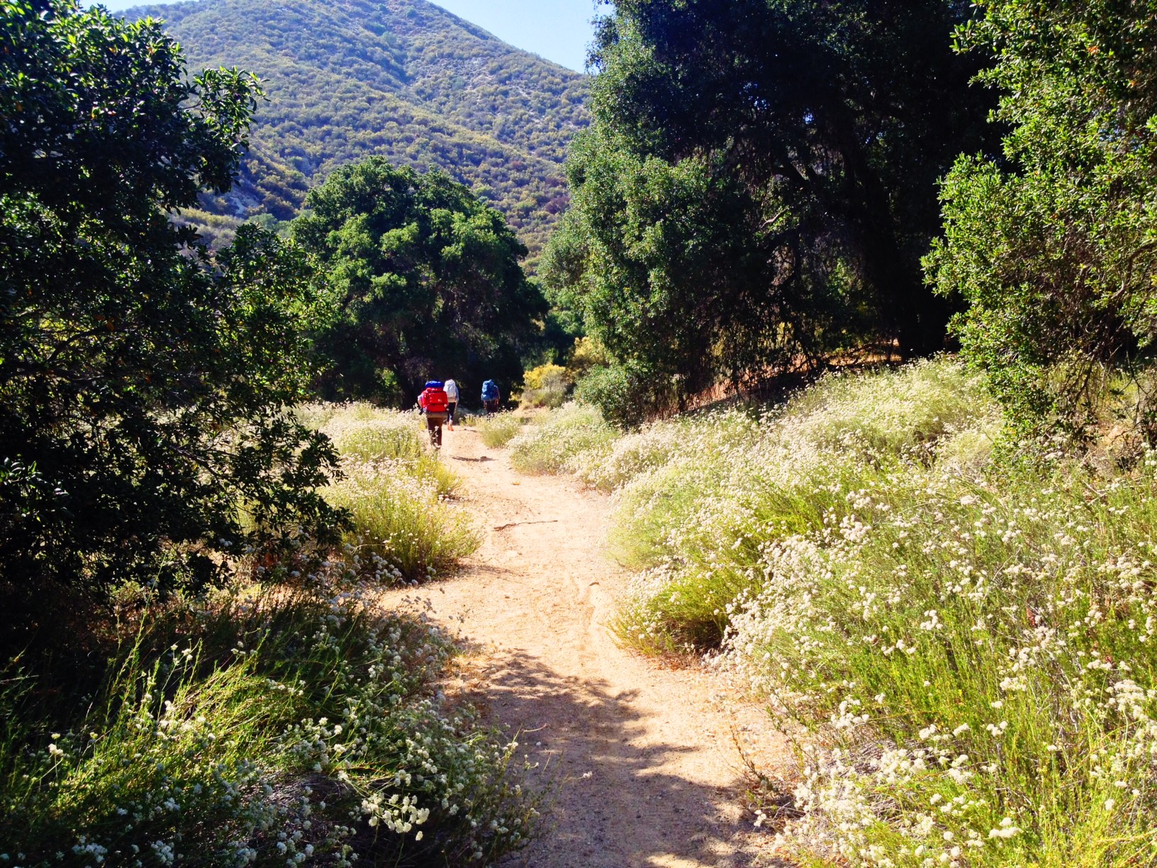
We had tofu salad sandwiches on a rocky beach before heading up the trail. There was still a little bit of cloud cover as we started hiking up, giving us a little relief from the blazing summer sun. The trail made its way up along the hillside, giving us a spectacular view of the coast. It was nice to have a cool sea breeze since there was about 1800′ elevation gain. I loved seeing how the terrain changed as we moved through the hills, starting out with dense, varied bushes and flowers (and poison oak) to a field of dried grasses. The path was clear the whole time though and we passed a handful of day hikers on the way up.
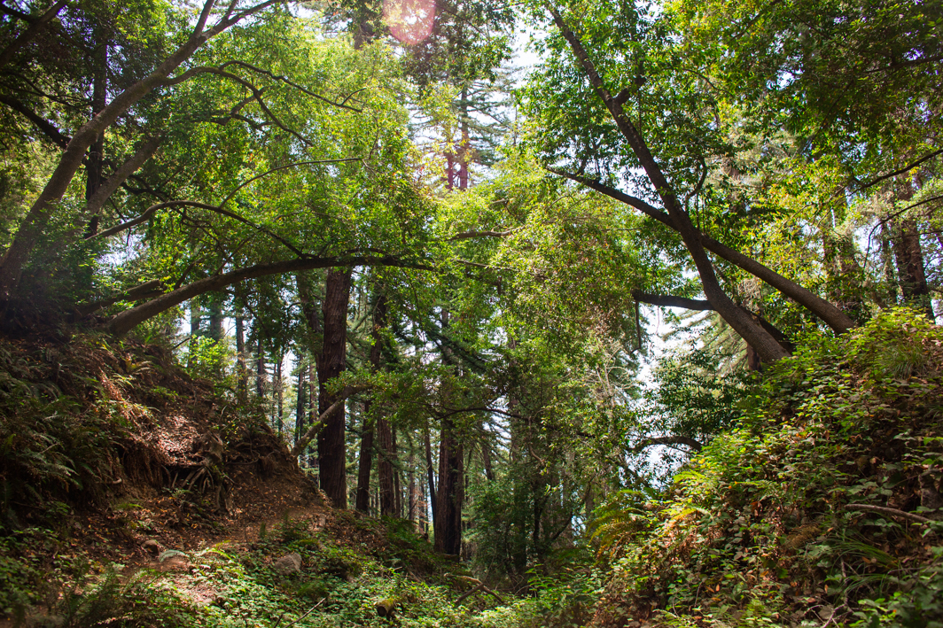
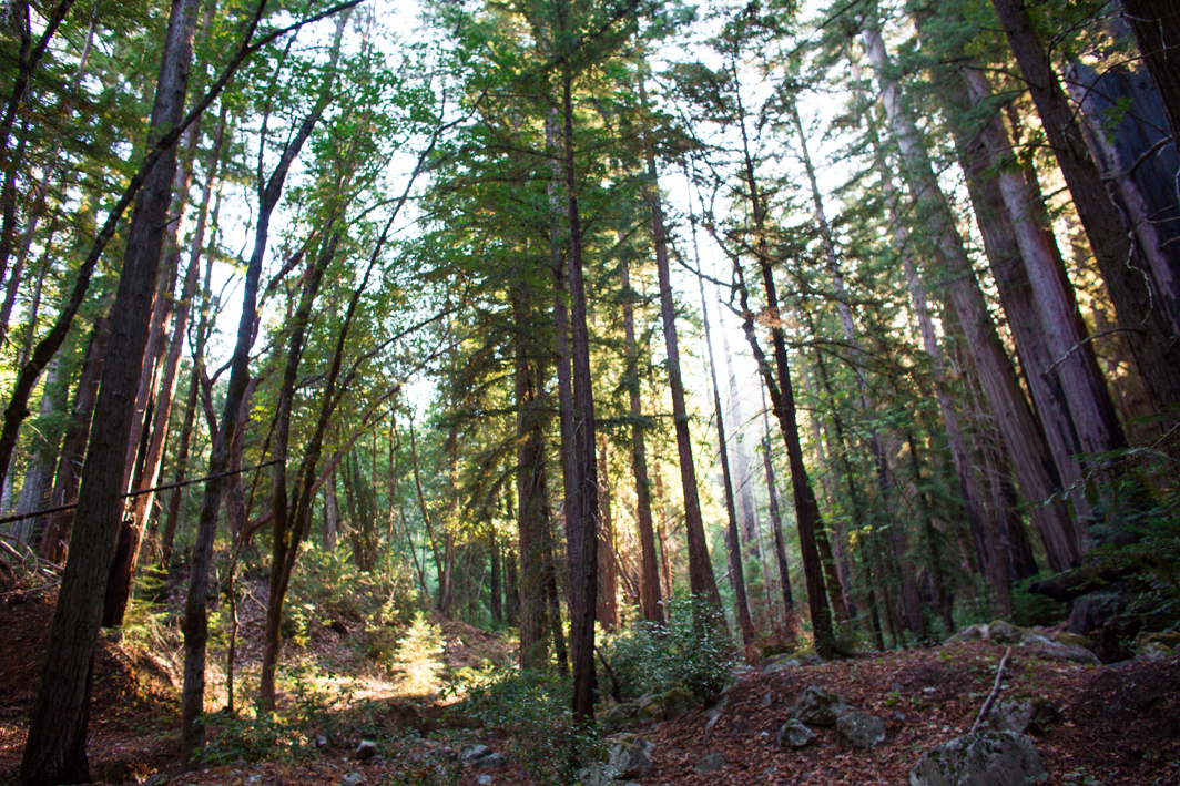
We reached a view point and stopped to take a look at ocean expanse in front of us. In the distance we saw something in the water and realized it was a whale. From so high up, it was hard to comprehend the scale of the tiny tail fin in the water. Up and up we went on the trail until finally the trail turned away from the water and we started heading into the valley. We passed the Espinosa Camp and the tiny spring right after it but kept on going. Soon we were surrounded by coastal redwoods and heading steadily down. Finally we found ourselves in a clearing at the Vicente Flat camp.
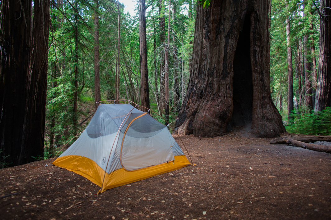
The first campsite is quite large with room enough for all three of our tents and even featured a picnic table. The river by the site was dry but there was water running about a quarter mile beyond. There were several other people camping in the area but far enough away that we didn’t hear them or really see them beyond passing by when collecting water or hiking out in the morning.
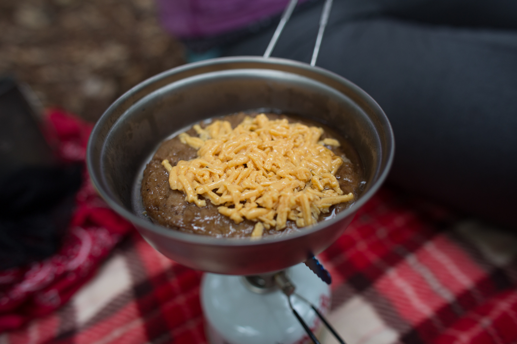
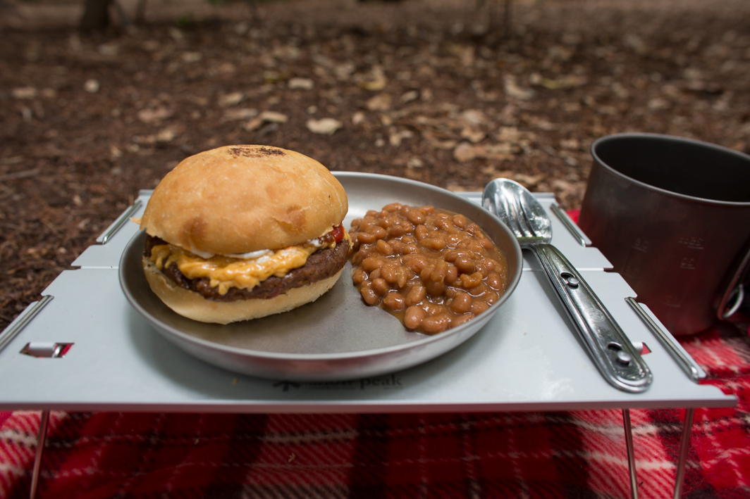
For dinner we grilled some veggie cheese burgers and baked beans. Daiya cheese is not my favorite but it is the absolute best on a veggie burger or breakfast sandwich. I was excited that the burgers fit perfectly in the fry lid of my snow peak trek 900.
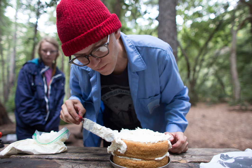
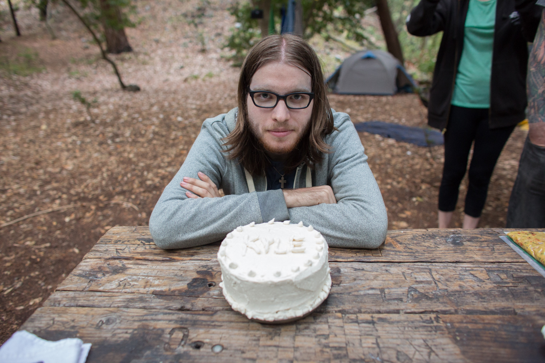
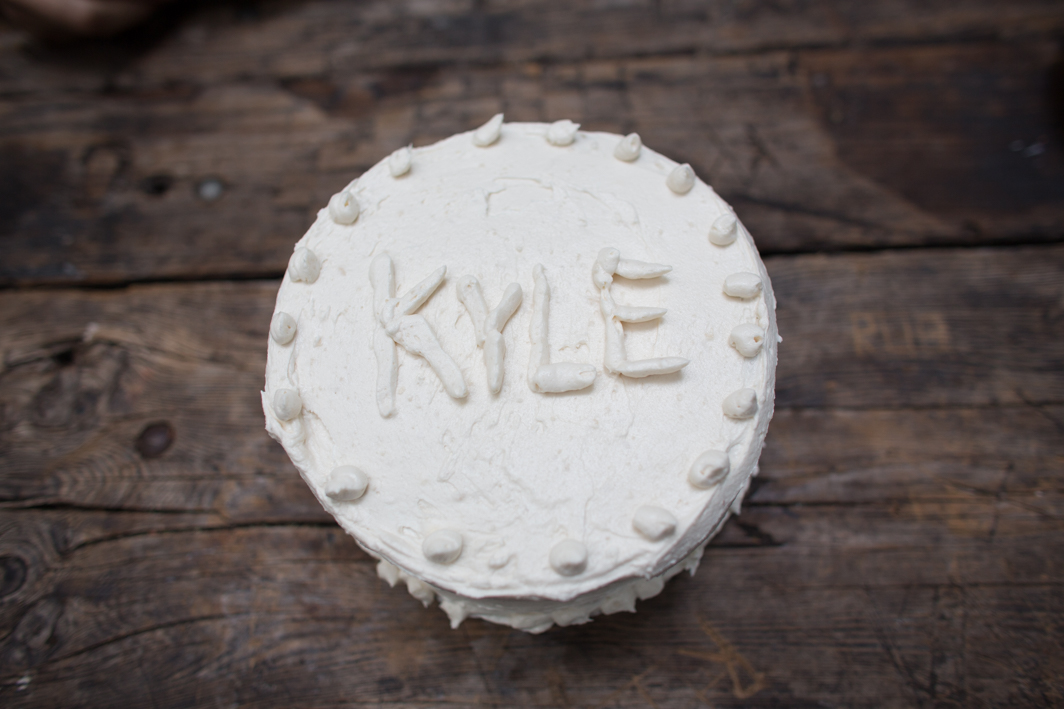
Shawn thought it would be awesome to bring a cake for Kyle so I cooked one up the day before we left and froze it along with a bag of frosting. We divided the elements between us in our backpacks so the cakes weren’t terribly crushed and the frosting was still cold when we arrived. Shawn did the honors of frosting the cake when we arrived and we ate almost all of it (some nearby campers took the last pieces off our hands). It was super tasty and we were all pretty stuffed.
We just relaxed for the rest of the evening and goofed off with some glow sticks. I watched some bats circle one of the nearby redwoods as the light faded. We had picked up a new light weight tent before this trip and it was awesome. Super cozy but not claustrophobic. I was pretty sure I heard some animals in the night and in the morning we saw a baby skunk running down the riverbed. So adorable! In the morning we had breakfast, packed up and headed back. The hike out was just as stunningly beautiful as in the way in.
photos by Shawn Bannon
Hiking Fish Canyon Narrows
 Another brief weekend adventure, backpacking in the Fish Canyon Narrows. It’s a trail not too far from Los Angeles that made it great for an overnight trip where we couldn’t get going until later in the day. The trail once lead to a maintained campground that was left to decay after a road was washed out and never repaired.
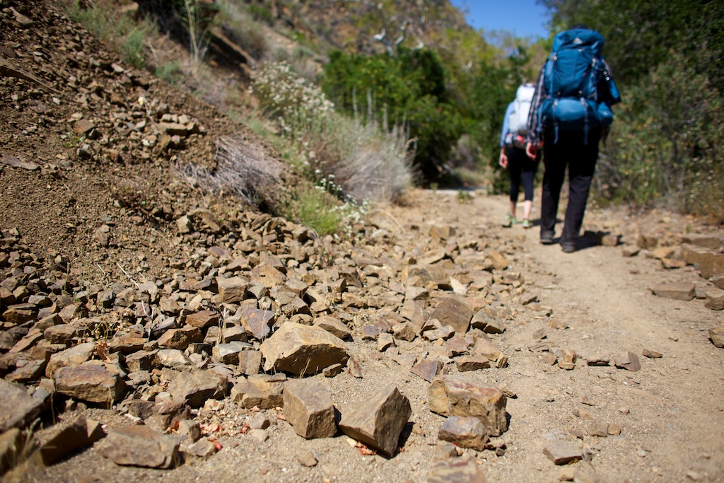
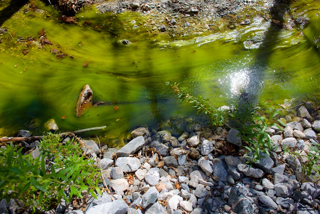
We left in the mid-afternoon, the heat bearing down on us as we walked through the exposed, dry hills. I was excited because even though I had brought lots of extra water, my backpack was still fairly light, all things considered. We walked the open trail until we reached a paved area between two rock walls. Here the creek had eroded the concrete, forming small, clear ponds of water. As we considered how nature had reclaimed its space, we spotted some snakes at the bottom of the pools (which I believe were garter snakes).
 Down the path a bit more we came upon the abandoned campground. It is now grown over into a lovely meadow. A few posts and fire pits still remain, as do the toilets, which have been shot up and spray painted as abandoned structures often are. Here is where we started to see signs of the poison oak we were about to find ahead of us.
The next mile or so was a lovely mix of oak trees and tall grasses. Growing up in this dry desert place, I’ve always been more fond of leafy green woods, but I’m starting to appreciate the unique flora of Southern California. We came upon the Pianobox mine, which has since been filled, but some equipment still remains. Then it was time to enter the narrows.

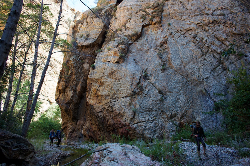
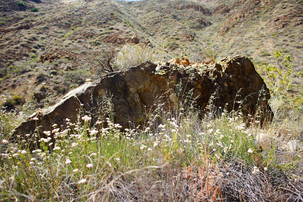
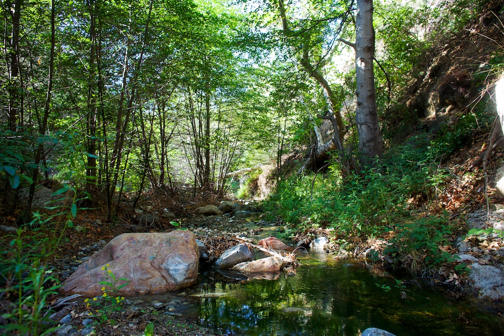
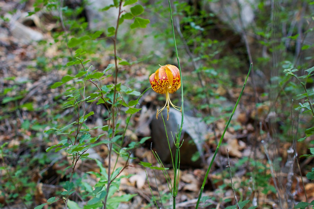 The creek in this section runs between two rock walls and there isn’t a clear path for the rest of the way. It’s a beautiful place, with the flowing water and red rock. We marched along gleefully at first, skipping over the stream on rocks. As we went on, there was less and less of a trail, as sections beside the water had become overgrown, often with giant swaths of poison oak. Still we moved forward, sometimes climbing over large rocks rather than going through the water. Though there wasn’t much incline, we all were quite tired as the mile that remained to our camp dragged on. It was fun but exhausting bushwacking through sections and navigating loose rocks and the ever present poison oak.

 It was hard to contain our excitement when we did finally arrive at the small camp. It was only a 5 mile trek but the narrows had really taken it out of us. It was slightly foreboding that some wooden talismans hung from the trees but we were happy to have a place to rest.
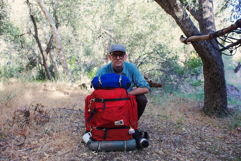
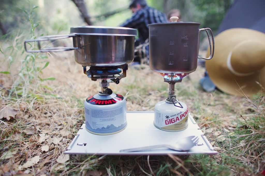
We set up camp and cooked dinner. You can see Shawn’s stove and mine next to it on his light weight table. Though he’s got an old school backpack, Shawn is growing to love some of the light weight gear. As the sun started to set, a wave of nausea started to roll over me. I had been having some trouble with the hose on my water reservoir and hadn’t been drinking enough water. In fact, I don’t think I drank any on the whole section through the narrows themselves. I ate a little and tried to drink as much as I could but I just couldn’t shake it or the anxiety that comes with being far from anything and feeling terrible. Even though it was dark, it was still hot when we climbed into our tents. When I was finally able to sleep, I had vivid dreams about rhinoceroses and giant tree monsters. Thankfully by morning I felt mostly better, though I didn’t sleep all that much.
 The hike out was lovely as we were able to conquer the tough section first. Also, rather than navigate over minefields of poison oak and loose rock we just accepted that our feet were going to get wet. It was sort of nice actually, as most of the trail was still hot and dry.
It was exhilarating to be on a trail where there were no other hikers, on a trail that in some sections was hardly a trail at all, but it was nerve racking at times. I would definitely do this hike again, especially now that I know what I was in for. With an earlier start, clocking in around 10 miles it would make a nice day hike.
hiking blogs i love
 Earlier this year I was researching National Parks and came across a map of the National Trails. Though I’d heard of the Appalachian Trail, and more recently had become aware of the Pacific Crest trail, I didn’t realize there was a network of several trails that wound around the country. As I dove into researching their terrains and paths, I found trail journals of hikers who had traversed these paths. Thus began my infatuation with backpacking. I thought I should share some of these great blogs with you, since they really are awesome and so inspiring.
Hiking the Pacific Northwest Trail
This was the blog that really started it for me. The Pacific Northwest trail is a newly designated National trail (only designated in 2009, though it was established back in the 1970’s) and has significantly less thru-hikers than more popular trails like the Appalachian Trail and the Pacific Crest trail. I found Katherine’s blog and gobbled it up all in one night from start to finish. She hiked the trail solo in 2013 in just over two months. I loved reading about her journey and it really opened my eyes to the troubles and joys of backpacking.
Carrot Quinn
I am currently obsessing* over Carrot’s journal of her hike on the PCT. I found her blog right before she started on the trail this year and was excited to travel along with her on her journey. This is her second year in a row hiking on the PCT and her writing is witty, fun and also earnest about the struggles of her expedition. You can go back and read about her hike from last year or even about some of her travels on freight trains. As of this posting she’s nearly 1000 miles into the trail.
*Sincerely obsessing, not just blogger hyperbole.
Myla Hikes
Myla and Jeff are hiking the Continental Divide trail this year after meeting last year on the PCT. They are true ultra light hikers and it’s interesting to read about their gear choices. Mostly I just enjoy following along reading about the different terrain of the CDT.
One Who Cannot
I found Steven’s (aka Twinkle) blog through Carrot Quinn, as they are in a small group of hikers traveling together. He has some great in depth writing about the trail and some lovely photos as well.
Other stuff:
Shawn and I watch a lot of hiking and gear videos and they’re usually pretty terrible, but I really liked this one about the CDT.
Do you have any favorite hiking blogs?